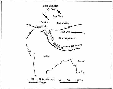
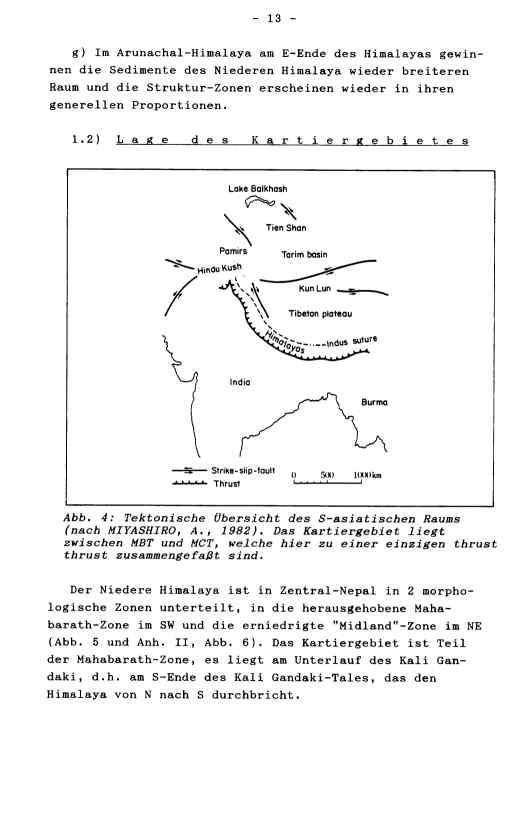
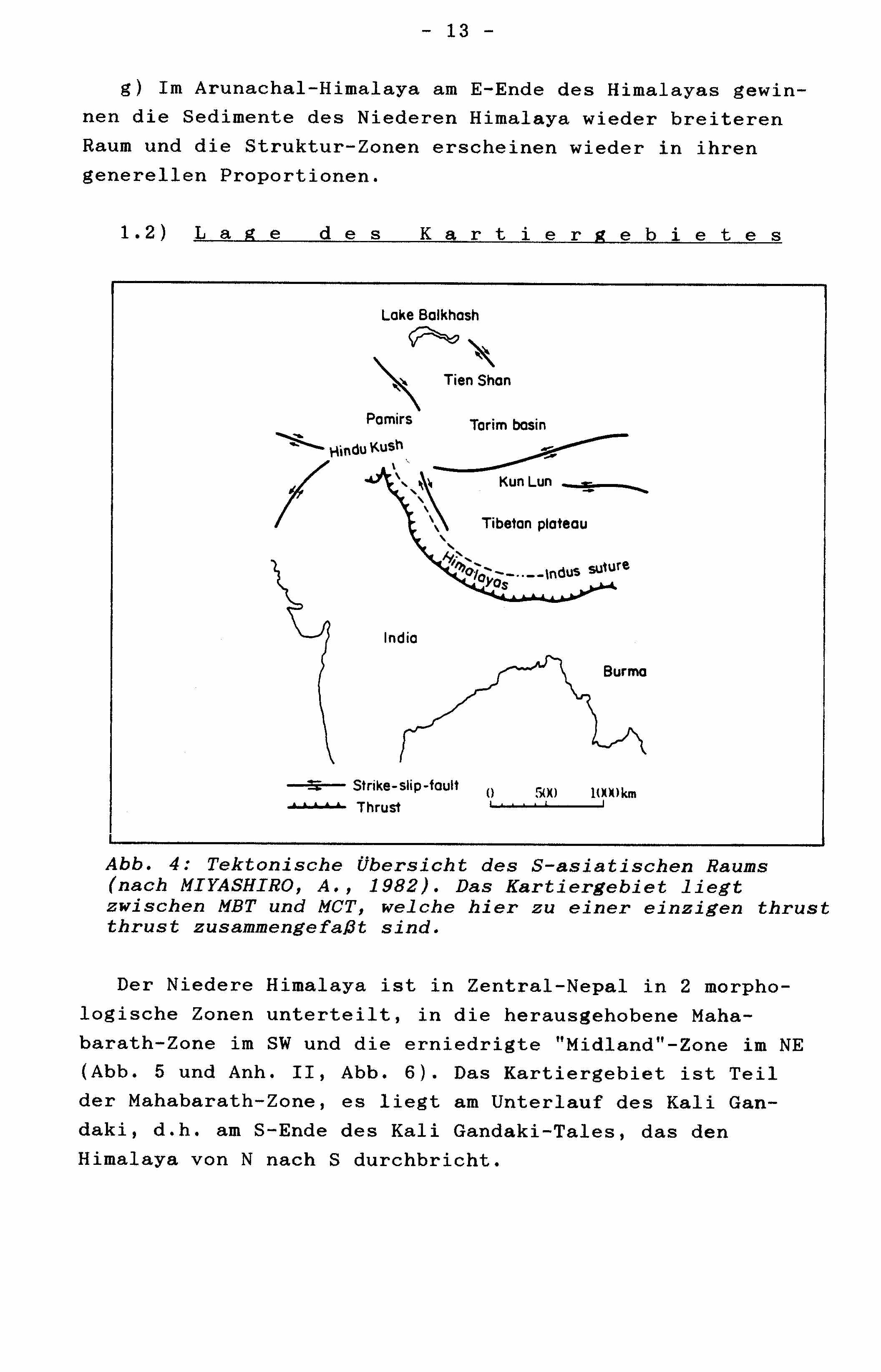
                             - 13 -

    g) Im Arunachal-Himalaya am E-Ende des Himalayas gewin-
 nen die Sedimente des Niederen Himalaya wieder breiteren
 Raum und die Struktur-Zonen erscheinen wieder in ihren
 generellen Proportionen.

    1.2)  L a g e   d e s   K a r t i e r g e b i e t e s
                             - 13 -

    g) In the Arunachal Himalaya at the SE-end of the
 Himalaya the sediments of the Lesser Himalaya become
 broarder again and the general vertikal classification
 appears undistorted again.


   1.2)     P o s i t i o n   o f   t h e
               m a p p i n g   a r e a
    Der Niedere Himalaya ist in Zentral-Nepal in 2 morpho-
 logische Zonen unterteilt, in die herausgehobene Maha-
 barath-Zone im SW und die erniedrigte "Midland"-Zone im NE
 (Abb. 5 und Anh. I, Abb. 6). Das Kartiergebiet ist Teil
 der Mahabarath-Zone, es liegt am Unterlauf des Kali Gan-
 daki, d.h. am S-Ende des Kali Gandaki-Tales, das den
 Himalaya von N nach S durchbricht.
    The Lesser Himalaya in Central Nepal is dividet into two
 morphological zones, the higher Mahabarath zone in the SW
 and the lower Midlands in the NE (compare Fig. 5 and Fig.
 II-6 !). The mapping area is part of the Mahabarath zone,
 it is situated to the lower reaches of the Kali Gandaki
 river, that means at the S end of the Kali Gandaki valley,
 which breakes through the Himalaya from N to S.
|